The Ultimate Guide to Hiking in Dallas
- Date Published
- May 13, 2019
- Category
- Business, Community Involvement, Events, General Info, Travel
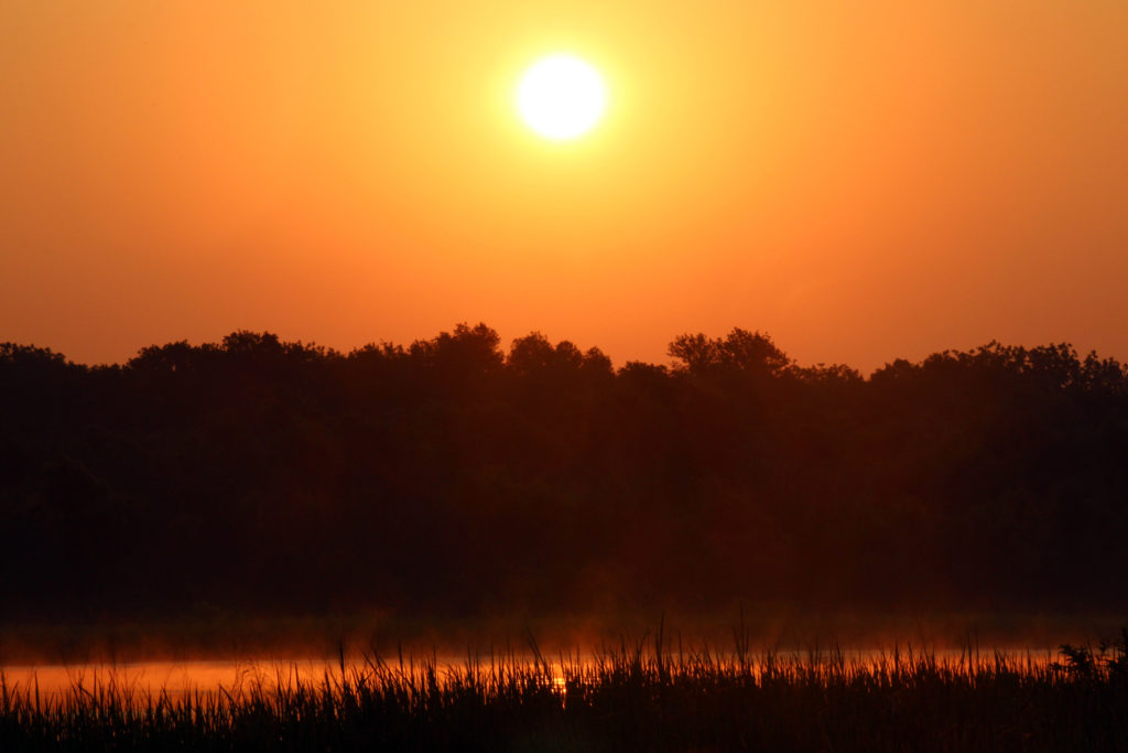
Sunrises like this one at the Trinity River Audubon Center await. (Photo courtesy of Ben Sandifer)
A guide for where to find a short hike versus long, how to traverse unmarked territory, what you can expect to see, and more. BY BILL HOLSTON PUBLISHED IN FRONTBURNER MAY 8, 2019 3:17 PM
For many years I’ve heard people say there’s no hiking in Dallas. This list is my retort.
The hiking trails here share several things in common. They all include hiking on natural surfaces—not just concrete. Most are long enough that you can get some exercise. There are notable natural features. All offer a sense of isolation and peace. All can be reached within 30 minutes from the heart of Dallas. And I’ve hiked and enjoyed every single one, some quite often.
To go beyond the Katy Trail and find Dallas’ hidden beauty, all you need is a sense of adventure, some planning, and good walking shoes. Every single season I see wildflowers, beautiful towering trees, fall colors, flowering shrubs, clear streams running over limestone, and an abundance of birds. This winter, deep in a forest, I watched great horned owls.
While it’s true we don’t border a national forest, we do have the largest bottomland, hardwood urban forest in the U.S. It was given the name Great Trinity Forest by the late naturalist Ned Fritz. A small, intrepid group of us hike there most weekends.
Before we get to the trails, it’s worth it to run through a few words of warning. Some of the trails are poorly marked and maintained. Spring Creek Forest Preserve, Cedar Ridge Preserve, and Dogwood Canyon have very active groups who do trail building and maintenance. Those hikes offer better laid out and clearer trails. But on most of these trails, there is very little signage, if any. On that point, a quick note to the city: while we continue to mull over multimillion-dollar trails throughout Dallas, the city would do well to consider the outsized return on investment available in simply putting up some cheap signage. But in the list that follows, I’ve tried to include notes to counteract this deficiency.
These are urban hikes. Because of this it’s likely you’ll encounter the trash that is a ubiquitous sign of modern urban life. Poison Ivy is abundant. (Leaves of three….Let it Be…Let It Be…Let it Be…whisper words of wisdom.). And we have all the Texas varieties of venomous snakes; all of them can be avoided by just watching your step or reach. More hazardous are loose limbs, which can cause tripping or can themselves fall without warning. None of this should keep you from getting out there and taking in Dallas-Fort Worth’s natural offerings.
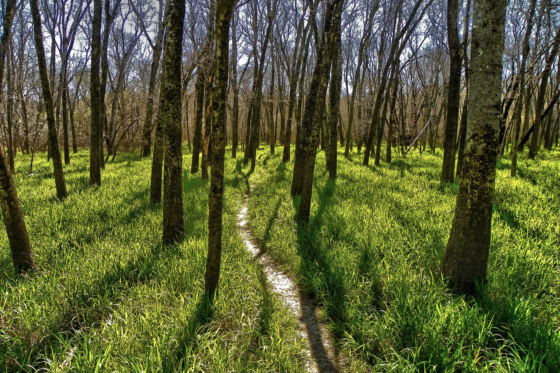
Spring Creek Forest
Garland
Spring Creek Forest (courtesy Ben Sandifer)
Notes about location: There are two parking areas: 1770 Holford Road and 1787 Holford Road, Garland, TX 75044
Distance: There is a one-mile paved trail at 1770 Holford. If you are inclined to explore, continue under Garland Avenue to access another two to three miles of natural surface trails. At 1787 Holford, you’ll find an interpretive trail, with a guide describing the ecosystems you’ll encounter as you go. Volunteer master naturalists lead hikes from both locations throughout the year.
What you’ll see: This is the largest expanse of old-growth hardwood forest in the entire area. There are shumard oak, chinquapin oak, and bur oak, pecan, walnut, sugar hackberry. Elm and ash are also plentiful. The forest is carpeted with lush wild rye and inland sea oats. In February, a large colony of trout lilies cover the forest floor. There is abundant bird life. In the summer, painted buntings enjoy the forest edge. It’s common to see red shouldered hawks. If you are observant, you’ll see great horned owls. In the spring, the two native prairie remnants are covered with abundant wildflowers. You’ll see Missouri primrose, wine cup, Indian paintbrush, prairie clover, and basket flower.
What else: This is a special place. The trees are enormous. The creek is clear, flowing over limestone. My favorite spot is a gravel bar. I carry a journal and a book, and sit and enjoy the sound of flowing water.
Cedar Ridge Nature Center
Southwest Dallas
Cedar Ridge (courtesy Ben Sandifer)
Notes about location: 7171 Mountain Creek Parkway, Dallas, TX 75249; the parking area fills up early when it’s nice out.
Distance: There are over nine miles of well-marked and maintained trails.
What you’ll see: At an elevation of 755 feet, this is a touch of the Hill Country in DFW. The preserve is on the top of the White Rock Escarpment. The hills are covered with eastern red cedar, ashe juniper, and shin oak. There are a couple of streams.
What else: These are the best hills in our area, so you can actually get a workout here. My favorite trail is Cedar Break; there are hills to climb and some pretty views. I prefer to combine it with the Cat Tail Pond hike. In the meadow, you are sure to see painted buntings in the summer. In February, the hills can be covered in trout lilies. Kids will particularly enjoy hiking to Cat Tail Pond.
This is our best local place to hike.
Arbor Hills Nature Preserve
Plano

Arbor Hills (courtesy Ben Sandifer)
Notes about location: 6701 W Parker Rd, Plano, TX 75093
Distance: 2.3 miles of paved trails and about two miles of natural surface trails.
What you’ll see: There are miles of paved trails for people with kids in strollers. There are Dallas Off Road Bicycle Association (DORBA)-built bike trails. These can be tedious for hikers. But the nature preserve is a great spot in the spring to see wild flowers in native prairie. In the bottomland, there are large trees like bur oaks and cedar elms and expansive views from a few hills. Painted buntings can be seen commonly starting in about June.
What Else: There is a lot of diversity here. You can see bottomland forest and native prairie. If you take the loop hike, you can access a tributary to Indian Creek which is a very pretty, clear creek in wooded bottomland forest. It’s a great spot to hang out and let little one’s explore. This is the best hiking area for those in the northern parts of our community.
Trinity River Audubon Center
Southern Dallas

Trinity River Audubon Center (courtesy Ben Sandifer)
Notes about location: 6500 Great Trinity Forest Way, Dallas, TX 75217
Distance: There are about four miles of well-marked and maintained trails.
What you’ll see: This used to be 120 acres, a former dump transformed by the Audubon Society and the city of Dallas. Now it’s a wetlands attracting birds year-round. This is a great spot for birding. There are boardwalks and bird blinds. There are fewer dirt trails, but this is the easiest spot to explore the Trinity River. It’s an easy walk on paved trails. The third Thursday of the month is free. Otherwise, there’s a small fee.
What else: It’s a great introduction to hiking, with abundant options. Most of the trails are paved, and the boardwalks can be accessed by wheelchair with some effort. That’ll be enough for many, but if you really want to explore, there is a nice natural surface trail that can be accessed off the paved trail. Look to your left as you approach the pedestrian bridge. You’ll see it. You have to cross Elam Creek, which is prone to flooding. You can follow the trail all the way to McCommas Bluff from there, where you’ll once again reach a paved trail leading to the Gateway Trails. You can follow all the way to the Loop 12 Boat Ramp. At River Oaks Park, you can access Lemmon Lake, a real bird sanctuary. You’ll possibly see wood storks and roseate spoonbills here; but beware, this requires real effort and cutting through heavy brush and poison ivy. Another option involves cutting across Loop 12 and walking the paved trails at the lower chain of wetlands. Those wetlands can have abundant birdlife, especially winter ducks.
Dogwood Canyon Audubon Center
Cedar Hill
Dogwood Canyon (courtesy Ben Sandifer)
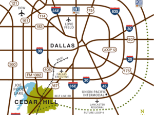
Notes about location: 1206 FM1382, Cedar Hill, TX 75104; just south of the entrance to Cedar Hill State Park
Distance: There are about three miles of well-marked and maintained hiking trails.
What you’ll see: This is a great, easy place to hike. There are about three miles of natural surface trails. The main trail begins at the visitor center (also worth it to note: there’s an awesome, elevated spot to view birds from inside the center). The trail climbs up on top of the White Rock Escarpment. The park is smaller than Cedar Ridge Preserve, but has similar terrain. On top of the escarpment you’ll walk through a forest of shin oak and red oaks. There is a short climb, and at the top of the escarpment the trail is a loop hike. There are several spots to get some nice views of the surrounding hills. In February, there are colonies of trout lilies along an intermittent stream. In spring, there are blooming Mexican buckeyes on top of the escarpment. You’ll also see blooming rusty blackhaw viburnum, a very showy native understory tree. Master Naturalists lead hikes and volunteers maintain trails here.
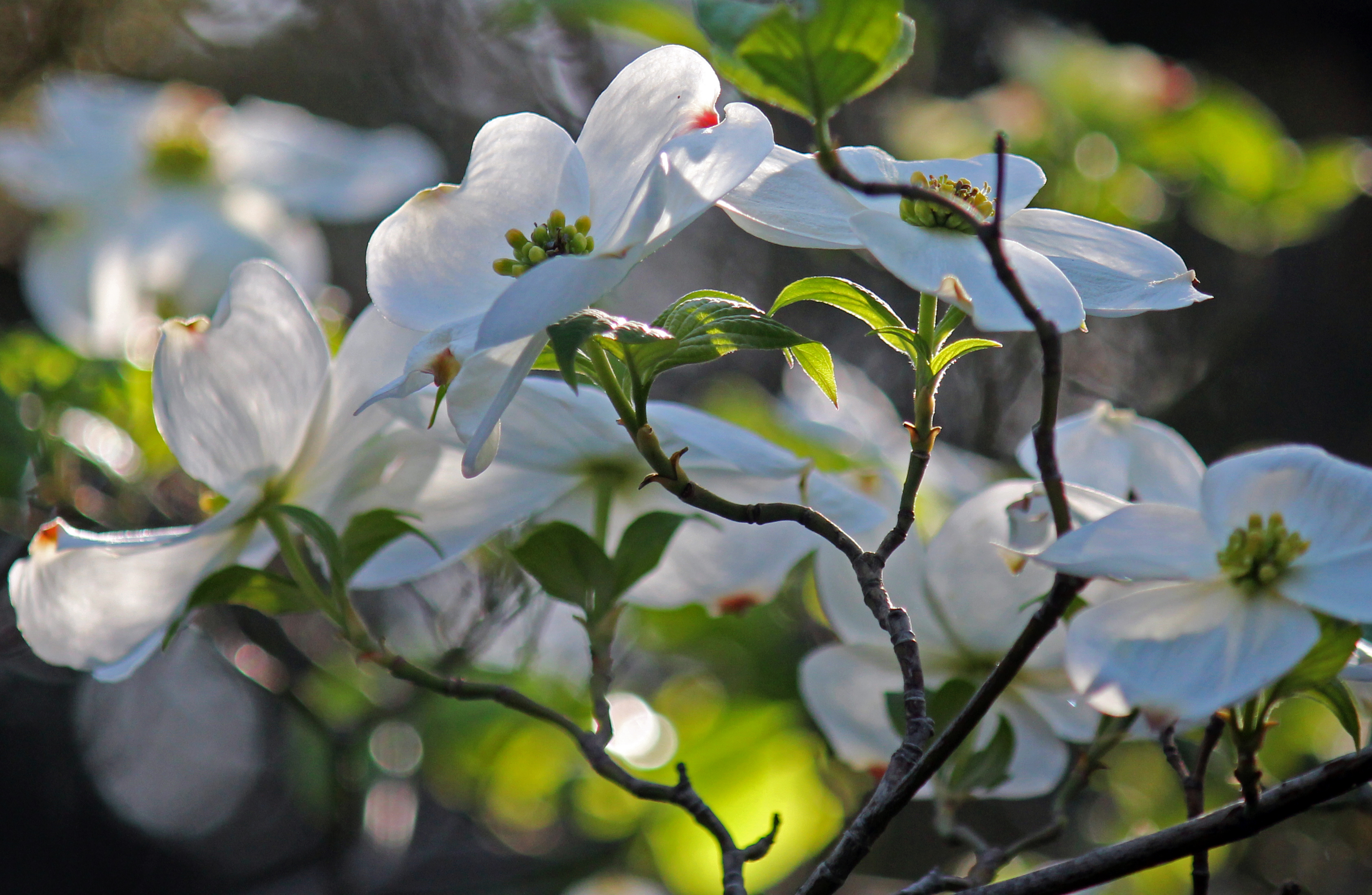
The best feature is the guided hikes to the blooming dogwoods. This is about the only stand of native dogwoods in our area and can be breathtaking in the spring, when they’re in bloom. The hikes are advertised on the Center’s website and usually occur in March. There is a small fee for the guided hike. All told, there are about three miles of trails at Dogwood Canyon.
What else: Cedar Mountain is right next door, which you can access via the paved trail from the parking area. A short dirt trail forms a loop and access to the hills.
The Buckeye Trail
Southwest Dallas
The Texas Buckeye Trail (courtesy Ben Sandifer)
Notes about location: 7000 Bexar Street, Dallas, TX 75215. The trailhead includes a small pavilion with picnic tables and a kiosk with a map of the trails. There is a cul-de-sac for parking.
Distance: The hike to the buckeyes is about two miles.
What you’ll see: Master Naturalists maintain several miles of trails. As you descend on the other side of the levee, you enter an unexpected world of trees and grasses. Follow the paved trail and you’ll find two dirt trails that lead to the buckeyes. The trails have been impacted by floods and around the spring are usually flagged with red flagging tape. After rain, the area can be very muddy. The buckeyes are beautiful, flowering trees and bloom usually in late March, which is around the time Master Naturalists usually lead hikes to see them. The rest of the year, you can walk in the shade of towering bur oaks, pecans, and cedar elms. One of my favorite hiking experiences is in spring, walking through the fields of Virginia wild rye, a native grass. It is brilliant green. The swamp privet is covered in yellow blooms. Our native maple, the ash leaf maple, is blooming as well.
What Else: There’s a less-traveled “trail” that leads to where White Rock Creek empties into the Trinity River. If you have a mind to explore, the path begins by a giant bur oak, close to where the grove of buckeyes is, and the beginning of the route is marked with flagging tape. It’s difficult to follow, but if you keep the river to your right, you’ll eventually connect with White Rock Creek. It’s hard to hike in a more remote spot. If you are up for a real off-trail experience, follow the levees to the lake called Homer Simpson Lake, and then cut cross-country to the mouth of White Rock. There is no trail and this can be difficult to navigate.
After the hike, check out the new cafe at Bonton Farms. You are parked right next to it!
Goat Island
Hutchins
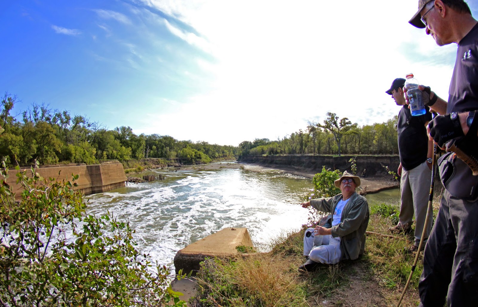
Our author on the banks of Goat Island’s lock and dam No. 2. (courtesy Ben Sandifer)
Notes about location: Post Oak at Fulghum Road (2800 Post Oak, Hutchins, TX 75141). One of the best features of this hike is access to one of the 100-year-old historic lock and dams along the Trinity. These were an ill-fated attempt to make the Trinity navigable. The easiest way to find it to is to follow the levee all the way from the parking area to Beltline Road, look for a dirt trail branching off to the left, and follow it toward the Trinity River. In about three-quarters of a mile you’ll find Lock and Dam No. 2, completed in about 1914. It’s an impressive feature and produces a cascade of water that’s a wonderful thing to see and hear. (Across Beltline, there is a gun range, so you’ll hear gunfire.)
Distance: There are over seven miles of well-marked and maintained trails.
What you’ll see: The lower trail passes through mixed hardwood of elm, sugar, hackberry, green ash, and bur oak. The forest floor is lush with Virginia wild rye.
What else: There are two main trails; one follows an old levee. The trails are long and, for the most part, easy to follow. This is one of the better places to get some miles on dirt trails. There is a great sense of remote wildness. There are a number of places where DORBA has built mountain biking trails. These branch off the main spine trail. The area is flood prone and can be very muddy.
Great Trinity Forest Gateway and Horse Trails
Southern Dallas
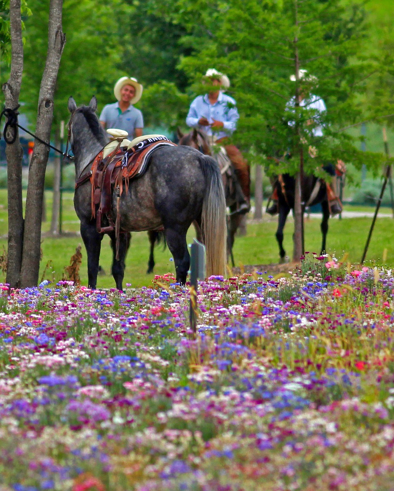
Great Trinity Forest Horse Trails (courtesy Ben Sandifer)
Notes about location: 2161 Dowdy Ferry Road, Dallas, TX 75217. There is tons of parking, a small fishing lake, and picnic pavilions.
Distance: There are paved and dirt trails, which combined can be about four miles of hiking.
What you’ll see: The trails parallel some open fields. These fields attract lots of birds and are filled with wildflowers. The dirt trails are built and used as horse trails, so they can be in rough shape when muddy. The trail goes close to the river. Bird life is abundant and it’s not uncommon to see great horned or barred owls. The paved trail eventually leads to McCommas Bluff, one of the most impressive features along the Trinity River. If you look downriver you’ll see the remains of Lock and Dam No. 1. This area served as an excursion destination by boat from downtown Dallas in the early 20th century, because it’s a prominent limestone bluff overlooking the river, and accessed some still running springs.
What else: You can continue hiking on the dirt trail. The trail crosses a couple natural springs, which can be muddy, but cool to see. The trail eventually crosses Elam Creek (impassable after a flood) and the paved trail which can be followed to Trinity River Audubon to the right or Lemmon Lake to the left. There are a few dirt trails which branch off of the main trail, and these access small ponds, some remnant prairie and in one spot some Texas buckeye and trout lilies. This requires some adventurous exploring.